Angus and Rosemary's Miscellany
of Malvern - Local History
A short history of the Malverns
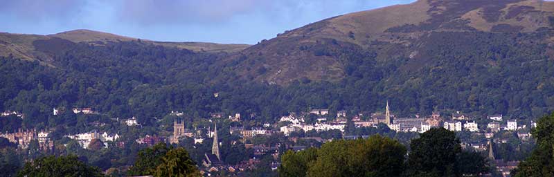
ContentsModern timesThe town of Malvern in the county of Worcestershire in the UK comprises in fact a number of settlements. These mostly run along and below the eastern slope of the Malvern Hills including Malvern Wells to the south, Great Malvern, shown in the photograph above nestling in the centre of the Malvern Hills, and Malvern Link, a light industrial area, to the north east. Spectacular views towards Hereford are to be had from houses in West Malvern but the roads are congested and parking is difficult here. At the bottom of the hills on the eastern side lies Barnards Green. On the left of the photo above are the buildings where the water cure doctors practised in Victorian times. Middle left can just be seen the Abbey Hotel clad in Virginia Creeper next to the tower of Great Malvern Priory, and below the spire of Christchurch in Avenue Road. Middle right can be see the spire of the United Reform church built a hundred yards south of the house where Princess Victoria stayed in 1830, and bottom right can just be seen the spire of Lansdowne Methodist church. The Malvern Hills in the background rise to a height of 425 metres, and are popular with walkers. Photographs of the area can be found in several publications in the local reference section of Great Malvern library, including (ref 1). Early daysGeologists currently think the earth was created about 4,000 Millennia ago. Land masses gradually moved huge distances around the globe until they are where they are today. Approximately 600 Millennia ago an eruption of hot lava under the sea formed the ridge which was to become the Malvern Hills. Much later, and before man existed, a vast river swept through the area between the Malverns and Evesham washing away the sediment, so that when the waters fell the ridge of the hills was eventually exposed. Skip the emergence of life on earth, climate change and ice ages, by 1066 the area around Malvern became a sparsely populated farming community with main settlements at Powick and Hanley with hamlets and farms in wooded wastes, probably surrounded by their own field systems. 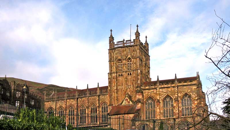
The south side of Great Malvern Priory Following the Norman Conquest in 1066 a monastery was set up in Great Malvern under Aldwyn and the Priory became the area's principal landowner. Between 1348 and 1350 the Black Death halved the population of England and the number of monks was reduced to ten as they looked after the dying people. The Priory at the centre of Great Malvern was ransacked in 1539 when King Henry VIII ordered the dissolution of the monasteries, but in 1541 John Pope and other townspeople were able to purchase the Priory for £20. There followed a long period during which the people of Malvern struggled to find funds to restore and maintain the building which we enjoy today. Malvern remained a quiet rural backwater until about 1756 when Dr John Wall analysed the water from various springs and the concept of hydrotherapy gradually took hold as in other countries, such as Germany. A boost was given to the 'water cure' in 1842 when Dr James Wilson and Dr James Manby Gully set up a hydrotherapy establishment at the Crown hotel. As the idea took off, hotels were built and more people visited the town to benefit their health. The gentry would, for example, meet at the reading room of the Royal Library at what is now Barclays bank before venturing up the steep lane next to the Unicorn Inn to St Ann's Well. Donkey rides were available for those who preferred not to walk. In 1830 the Duchess of Kent brought Princess Victoria, age 12, for a holiday, staying at Holly Mount Mansion on the Worcester Road. The Guesten Hall of the Priory was demolished about 1841 to make way for the Abbey Hotel. It had provided accommodation for the guests of the Prior, and it is thought that Henry VII, his wife and sons Arthur and Henry may have stayed here circa 1500. Drawings of the Guesten Hall hang in Malvern Museum.
Coming of the railwayThe first tunnel through the hills to Colwall, Ledbury and beyond was opened on 12th June 1861. The leaders in the town were influential in ensuring that the route of the railway and location of its stations and sidings did not upset the character of Great Malvern. Industry and eventsWhile mixed farming continued, people also became more and more involved in tourism, quarrying and education. John Severn Burrow (1828 - 1916) a wine merchant and bottler of mineral water on Belle Vue Terrace was one of those influential in the forming of Malvern College, a private school, which opened in 1865. The first headmaster was Reverend Arthur Faber, and there initially were six assistant masters and 24 boys. It is of note that John sent his son, who became a Barrister, to Harrow School. Malvern Girls' College, now Malvern St James, also grew from small beginnings. Starting with a kindergarten, building to 14 houses in Malvern and eventually taking over the Imperial Hotel opposite the station in 1916. Click to read about some of the founders of the school. Work on the Assembly Rooms which were developed to become the Malvern Theatres complex started in 1884. An account can be found on the Malvern Theatres website. The theatre complex was completely refurbished in 1997/8 when the covered terrace, where artists displayed their work for many years, was lost. 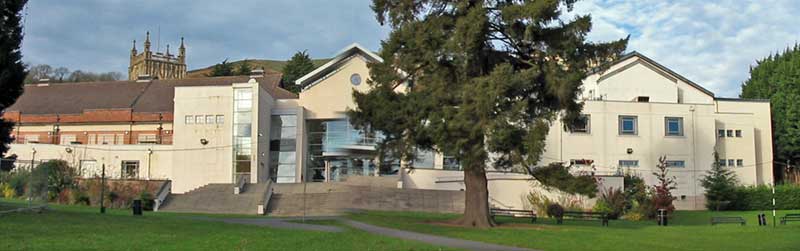
The Malvern theatres complex viewed from Priory Park Jubilee Drive, on the western slope of the Malvern Hills, was built in 1887 to celebrate 50 years of Queen Victoria's reign, and the Toposcope on the Worcestershire Beacon was erected to celebrate Victoria's Diamond Jubilee. Camp Hill reservoir and waterworks at British Camp were opened in 1891 in order to serve Malvern's increasing population. The Board of the Malvern Hills Conservators, rebranded in 2017 as The Malvern Hills Trust, was formed in 1898 to protect the hills leading to the end of quarrying operations. Before the installation of electric lighting in the Priory there was a gas chandelier, the lighting of which fascinated both adults and children. One of the earliest motor vehicles, the Santler, was built in Malvern and the famous Morgan Motor Company factory is located in Malvern Link, where during WWII Alan Cobham worked on flight refuelling. PeopleLady Emily Foley, 4th daughter of the Duke of Montrose, married Edward Thomas Foley of Stoke Edith in 1832. She became the principal owner of property in Malvern and influential in town affairs between her husband's death in 1846 and her own death on 1st January 1900. She made sure non-conformists did not get the best sites for their churches and did not disturb their neighbours with noisy music. A recluse and inventor, Mr Johnson, of Wynds Point or thereabouts, who died in the 1880's, is said to have built a Macadam road from British Camp to Little Malvern at his own expense. Before the railway this was a steep and dangerous track often washed away or blocked by fallen trees.
Many famous people have been associated with the Malvern Festival, including George Bernard Shaw (playwright), Edward Elgar (composer) and J B Priestley (writer). Other performers with associations with Malvern include Marie Hall (violinist), Jenny Lind (singer) and Nigel Kennedy (violinist). C S Lewis went to school in Malvern and the gas lamps on the Wells road may have inspired his description of scenes in his book 'The Lion the Witch and the Wardrobe'. Below a gas lamp at the foot of the 99 steps in Rosebank Gardens, leading towards St Ann's Well, you will find a new plaque, replacing an older one, which reads: CS Lewis 1898 - 1963 Scholar and Author Cherbourg House School Malvern 1911 - 1913 Malvern College 1913 - 1914 The Malvern Hills reminded Lewis of the Mourne Mountains at home in Ireland. A gas lamp appears in his story The Lion the Witch and the Wardrobe. At Magdalen College, Oxford, Lewis tutored George Sayer 1914 - 2005 who became a close friend and Head of English at Malvern College. Lewis, like JRR Tolkien, often visited him in Alexandra Rd, Malvern Link.
The writer and radio broadcaster Leslie Halward lived nearby in Guarlford and the television personality Jeremy Paxman was educated at Malvern College. Catherine Frances Severn Burrow, local artist and historian, the daughter of John Severn Burrow was instrumental in the setting up of the Barnleigh Housing Association. Quoting from the Malvern Gazette of 2010:
Catherine Severn Burrow once described Great Malvern as 'a little city set on a hill' (ref 2). The annotated photograph below shows the centre of Great Malvern viewed from Guarlford; click image to enlarge.
The Centre of Great Malvern More about the hamlet of Guarlford, which lies 2 miles east of Great Malvern, can be found in (ref 7 and ref 8). Radar comes to MalvernTREDuring WWII many military units were based in Malvern. One of these was the secret RAF Telecommunications Research Establishment (TRE) which began life at Bawdsey Manor, moved to Worth Matravers, near Swanage, following an unsuccessful move to Dundee, and finally moved to Malvern Boys' College in May 1942. Interesting accounts of TRE have been published by former scientist Dr Ernest Putley who died in 2009 (ref 3), Michael Bragg (ref 4), and Reg Batt (ref 5), while the reminiscences of residents who lived in Malvern during WWII can be found in (ref 6). Another author, Jack Nissen, gives a vivid personal account of the development of radar, and navigation aids, in his book Winning the Radar War (ref 6) although he seems only to have visited Malvern briefly. The sudden arrival of TRE and its sister establishment ADRDE following Churchill's decision to move these establishments away from the coast changed Malvern dramatically as there was a shortage of accommodation and locals were forced to accommodate the scientists and their support staff, at least until new accommodation was built. A flying accidentThe secret ground mapping radar H2S used as a night bombing aid later in the war was developed by TRE in conjunction with EMI. On 7th June 1942, a tragedy occurred after Halifax V9977 took off from RAF Defford on a test flight of the radar. A fire, believed possibly to have been caused by a loose tappet locknut, developed in a starboard engine resulting in part of the wing breaking off, and the aircraft turning over and crashing before a field could be found for an emergency landing - all the scientific team on board perished including Alan Blumlein, one of the brightest scientists of his time, who had invented stereo hi fi and made a significant contribution to the development of television. This event is remembered both in a window at Goodrich castle and memorial dedicated to the Telecommunications Flying Unit in the village of Defford. ADRDE
Local man Donald Hugh Tomlin (1918 - 2013), BSc Sheffield University 1940, was on the first coach to arrive from Christchurch in 1942; in later life he wrote letters to the Malvern Gazette correcting misinformation about ADRDE. ADRDE was renamed RRDE in 1944 and merged with TRE to form the Royal Radar Establishment (RRE) about 1953. After WWII there was a School of Electronics at North Site where apprentices were trained; an apprenticeship was highly prized and many apprentices went on to University. In the 1970s North Site became home to the Signals Research and Development Establishment (SRDE) which had moved from Christchurch, and a section of the Royal Electrical and Mechanical Engineers (REME), but there is no trace of the scientific developments which took place at Pale Manor Farm now, as the site was closed and sold for a large housing development known as Malvern Vale. The first roads on the development were named after the Malvern Hills, but 'Persimmon Homes' have included names relating to past scientists and occupiers of the site in the later phases of the development. There are apartment blocks named Somerford House, Tomlin House and Woodward House; and roads named Radar Avenue, Pale Manor Close, Randall Road and Redman Close:-
RRE and SRDE merged to become the Royal Signals and Radar Establishment (RSRE). This later became part of the Defence Evaluation and Research Agency (DERA) most of which was eventually privatised and renamed QinetiQ. Though having a reduced presence, QinetiQ is still a major employer in the town. A few scientists remained with the MOD joining the Defence Science and Technology Laboratory eventually moving from Malvern to Porton Down. The Malvern Town Council has continued to promote 'science' through the development of the Malvern Hills Science Park in Geraldine Road adjoining QinetiQ, light industry in Spring Lane, and development of the Enigma Business Park in Malvern Link. 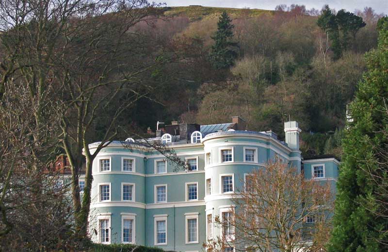
During the 1960s apprentices at the RRE were accommodated at the Park View Hostel, previously the County Hotel, which was later sold, refurbished and converted into apartments (see photo opposite). The building had been originally built for Dr James Wilson as a 'water cure' establishment in the 1840s. Malvern shopping parkReturning to modern times:- Following the death of the 8th Earl Beauchamp, land was sold by the Madresfield Estate for housing at Townsend Way and the Madford Retail Park in Roman Way. This popular out of town shopping centre, on the northern edge of Malvern Link, was renamed the Malvern Shopping Park circa 2016 it includes branches of M&S, Halfords, Argos, Next, Matalan, Boots and Morrisons, joined by Caffe Nero, Carphone Warehouse, and more recently Mountain Warehouse, Specsavers and Costa Coffee, attracting shoppers from a wide area. MorrisonsAs you enter the retail park turn right for the Morrisons supermarket and petrol. The car park is free but stay is now limited to shoppers at Morrisons for a maximum of three hours. Longer, there is the possibility of a fine, so we recommend you don't park at Morrisons if you are going into Worcester on the bus. There is a bus stop outside Morrisons; the frequent service 44 goes to either Worcester bus station or Great Malvern via Malvern Link; some services go on to County Hall and the Royal Worcestershire Hospital. 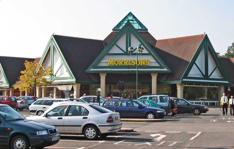
Turn left for the string of shops on the east side of the retail park. At the north end is Caffe Nero which has an interesting mural; next door is Carphone Warehouse. Caffe Nero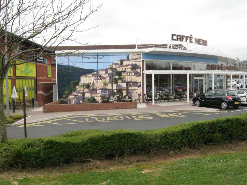
Carphone WarehouseHere you can buy a smart phone, such as the Apple Iphone, providing internet access and a Satnav capability in addition to phone calls. Nowadays it seems that little device in your pocket will tell you where you are and enable you to book a taxi. Potentially very helpful if you are in a strange city, providing you keep it charged. 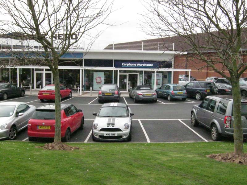
In 2015 a new retail unit was built in the small car park at the side of Marks and Spencer which is now occupied by a Poundland store. The next photo shows a glimpse of M&S and Halfords looking south towards Boots which is at the far end of the row of shops. Marks and SpencerShop for food and clothing, or have a snack in the cafe on the first floor. 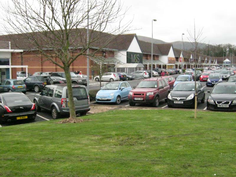
Round the corner from M&S and Caffe Nero you will find a fitness centre, pet shop, the Dulux Decorator Centre and County Kitchens and plumbing supplies. Just Pets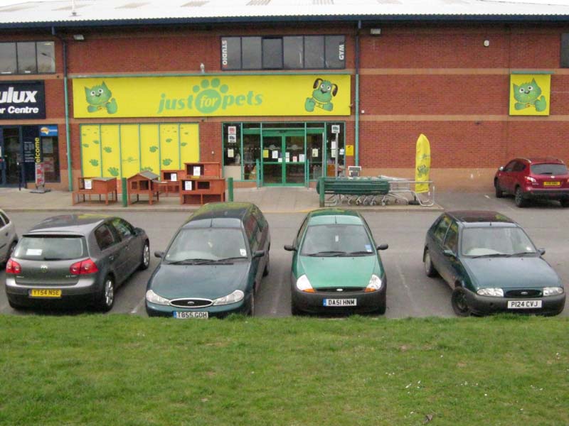
To the right of the pet shop is a door to stairs leading to the fitness centre on the floor above. Dulux Decorator Centre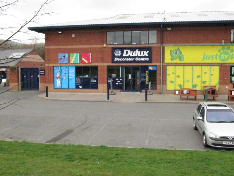
County KitchensAt the far end you will find County Kitchens with a showroom, and at a door further along, County Heating and Plumbing where you can buy plumbing supplies. These are offshoots of County Building Supplies in St Andrews Road which can be found opposite the entrance to Qinetiq. 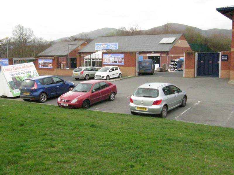
Back on the grass outside Caffe Nero, looking south, you can see McDonald's and looking west the Madford roundabout. McDonald's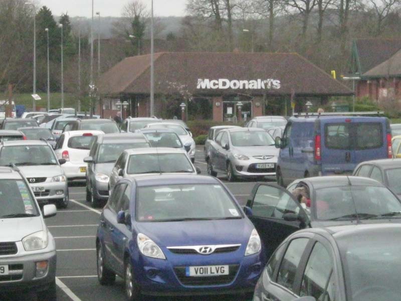
The Madford RoundaboutIf when you leave the retail park, you turn left, travelling west from the Madford roundabout, you will reach another roundabout on the road into Malvern Link where there was a Countrywide store (half right) and a Greggs food outlet on your immediate left. In Malvern Link there is a branch of B&Q. 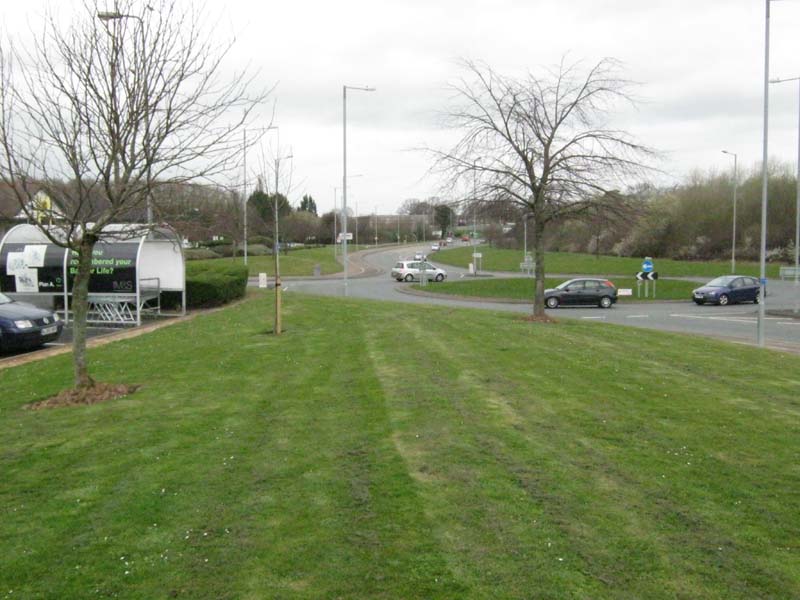
Turning right will take you into Townsend Way, near where is located the Eden Church, the Malvern Spa hotel, a Premier Inn and a branch of Screwfix. Click here to find out more about some other shops in Malvern References
|
|
Last updated 26th March 2019 |
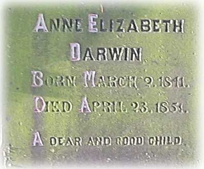 In 1851 Charles Darwin brought his ailing 10 year old daughter
 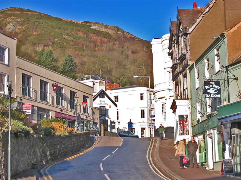 The road junction between Church Street and the Worcester Road at Belle
Vue Island (see photo left) was designed by Sir
The road junction between Church Street and the Worcester Road at Belle
Vue Island (see photo left) was designed by Sir 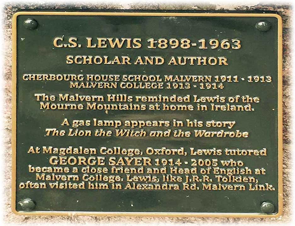

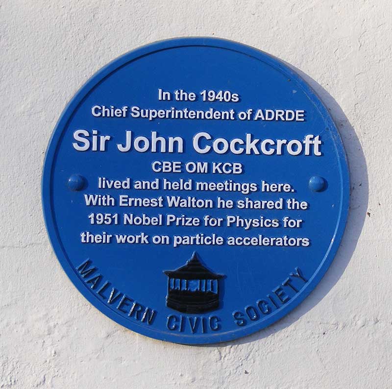 Also in 1942, radar developments at the Army Air Defence Research and Development
Establishment (ADRDE) at Christchurch moved to Pale Manor
Farm later known as RRE North Site in Leigh Sinton Road where
Also in 1942, radar developments at the Army Air Defence Research and Development
Establishment (ADRDE) at Christchurch moved to Pale Manor
Farm later known as RRE North Site in Leigh Sinton Road where